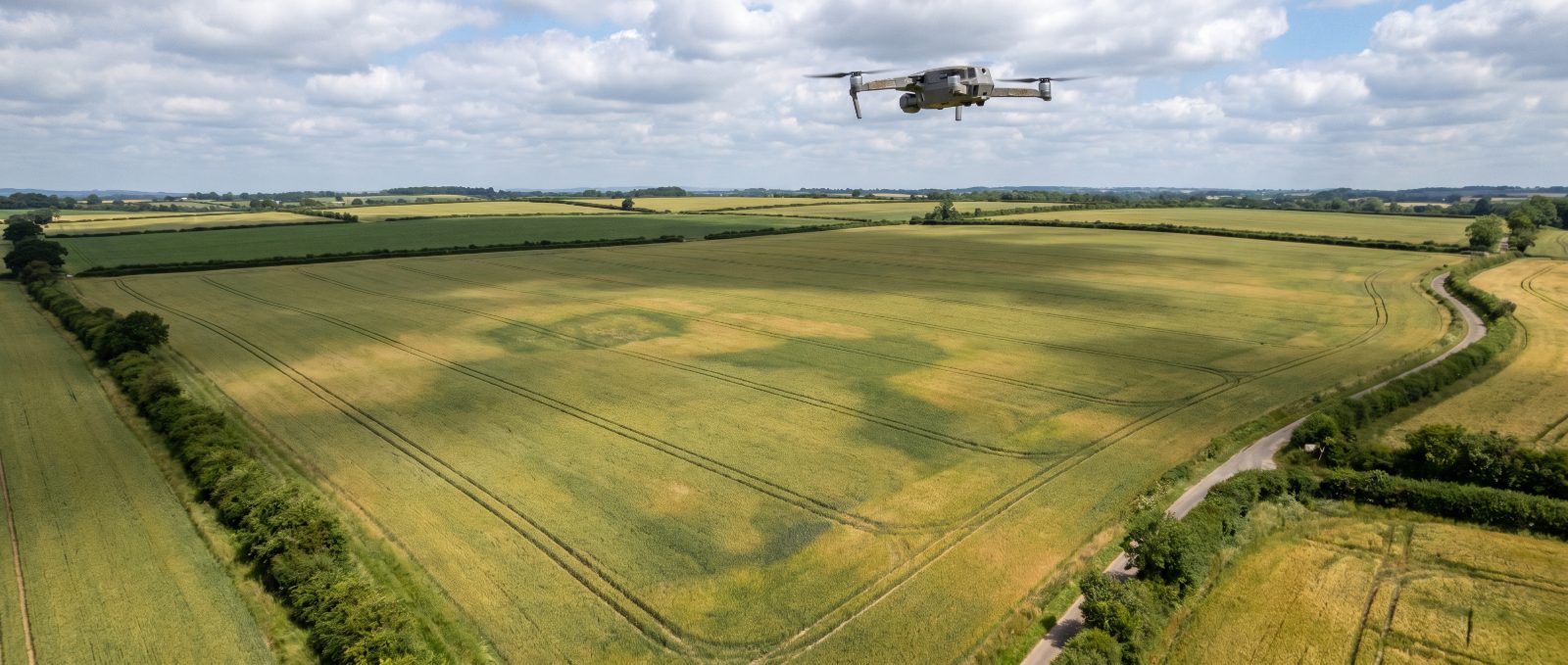
Agricultural drone mapping uses survey drones to capture images, maps and measurements of fields, crops and rural infrastructure. In the UK it supports crop scouting, field records, estate management, multispectral review and inspection work, and is often a lower-regulatory-risk starting point than aerial application. This page lists UK operators offering agricultural drone mapping.
What this service is
Drone mapping produces outputs such as orthomosaic images, elevation models, multispectral indices, measurements and reports. The value comes from how the data is interpreted for an agricultural decision, not just from the capture itself.
Because mapping does not apply products, it usually carries a different and often simpler compliance profile than spraying, spreading or seeding, while still requiring appropriate aviation permissions and insurance.
How UK agricultural drone mapping works in practice
The operator agrees the outputs, resolution, timing and area, then flies a planned survey pattern in suitable weather. Clarify exactly what you will receive: images, maps, measurements, reports or raw files, and who owns the data.
A strong agricultural mapping operator understands the farming context, including crop stage, agronomy questions and field records, not only drone capture. Ask how the outputs are delivered and whether interpretation or agronomy support is included.
Likely use cases
- Crop, field, boundary or drainage records.
- Multispectral or visual crop scouting for agronomists and land managers.
- Farm buildings, solar, estate, forestry or access-route inspection.
- Baseline surveys for stewardship, planning or land management.
What to ask before hiring
- Ask what outputs you will receive: images, maps, measurements, reports or raw files.
- Confirm resolution, timing, weather limits and data ownership.
- Check whether the operator understands agricultural context, not just drone capture.
- Confirm aviation permissions and insurance for the survey area.
UK Agricultural Drones is a directory and information resource, not the operator. Use the listings below as a starting point and confirm credentials directly before any work begins.
Related guides
- What to ask before hiring a drone operator
- Agricultural drone equipment and dealers
- What drone work costs
- Browse the operator directory
- Drone spraying services
Frequently asked questions
What is agricultural drone mapping used for?
It is used for crop scouting, field and boundary records, drainage and infrastructure checks, multispectral crop review and estate or forestry inspection. The outputs support agronomy and land-management decisions.
What outputs do you get from drone mapping?
Depending on the job, outputs can include high-resolution images, orthomosaic maps, elevation models, multispectral indices, measurements and written reports. Agree the exact deliverables and data ownership with the operator before booking.
Does drone mapping need the same permissions as spraying?
Mapping does not apply products, so it usually has a simpler compliance profile than application work, but the operator still needs appropriate aviation permissions and insurance for the survey. Confirm these for your site.
How much does agricultural drone mapping cost?
Mapping is usually priced by area and the outputs you need, so confirm with the operator what is included, whether images, maps, measurements or reports. Send the survey area and required outputs for an accurate quote.